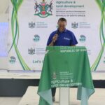
The Limpopo Department of Agriculture and Rural Development has taken a major step towards modernising agricultural service delivery through the official launch of the Agricultural Geo-Spatial Information Services (AGIS) Drone Services. The launch, held at the Limpopo Tourism Agency Headquarters in Polokwane, highlights the department’s commitment to using advanced technology to improve agricultural planning, monitoring and decision-making. Convened under the theme “Transforming Agricultural Service Delivery Through Drone Technology,” the event showcases how unmanned aerial systems can strengthen government services while supporting sustainable agricultural development. The introduction of drone technology reflects a growing recognition that digital innovation is becoming an essential part of modern farming and public sector operations. By embracing these technologies, the department aims to improve efficiency, reduce costs and deliver more effective support to farmers and rural communities across Limpopo.
Agriculture is one of Limpopo’s most important economic sectors, with the province producing a wide range of crops including citrus, avocados, tomatoes, potatoes, mangoes and nuts. Livestock farming also contributes significantly to the provincial economy, creating employment opportunities and supporting rural livelihoods. Managing such a diverse agricultural landscape requires accurate information that enables informed planning and timely decision-making. Traditional field inspections remain important but can be time-consuming and resource intensive, particularly when covering large farming areas. Drone technology offers a faster and more detailed method of collecting information, allowing officials to monitor agricultural conditions more efficiently and respond to emerging challenges.
The official launch brought together professionals from several divisions within the department, including Agricultural Geo-Spatial Information Services, Veterinary Services and Engineering Services. Their participation demonstrated the broad range of applications that drone technology can support across different areas of agricultural management. Rather than serving a single function, drones can assist with mapping, infrastructure inspections, environmental monitoring, livestock management and crop assessments. This collaborative approach encourages departments to share expertise while making better use of technology across multiple programmes. Integrating drone services into existing operations strengthens coordination and improves the quality of information available for planning and implementation.
One of the primary objectives of the AGIS Drone Services initiative is to improve planning and monitoring throughout the agricultural sector. High-resolution aerial imagery enables officials to assess crop conditions, identify changes in land use and monitor agricultural infrastructure with greater accuracy than many conventional methods. The information collected can assist with identifying production challenges before they become severe, allowing faster intervention where necessary. Accurate mapping also supports long-term planning by providing reliable data for resource allocation and infrastructure development. Better information ultimately leads to more effective government programmes that benefit both commercial and emerging farmers.
Drone technology has become an increasingly valuable tool in precision agriculture around the world. Equipped with advanced cameras and sensors, drones can capture detailed images that reveal crop health, irrigation performance and soil variability. Multispectral imaging allows specialists to detect plant stress that may not yet be visible to the human eye, enabling earlier responses to nutrient deficiencies, water shortages or disease outbreaks. These capabilities improve productivity while helping farmers use fertilisers, water and other inputs more efficiently. As climate change places additional pressure on agricultural production, technologies that support efficient resource management become increasingly valuable.
An important highlight of the launch was the department’s strategic partnership with the Department of Land Reform and Rural Development through a Memorandum of Agreement. This collaboration enables the Limpopo Department of Agriculture and Rural Development to conduct drone operations under the Department of Land Reform and Rural Development’s Unmanned Aircraft Systems Operator Certificate. Operating under this approved regulatory framework ensures compliance with aviation requirements while simplifying the implementation of drone services. The agreement also reduces operational costs and accelerates the deployment of drone technology across departmental programmes. Access to an established operational framework allows the department to focus on delivering practical benefits to agriculture rather than navigating lengthy certification processes independently.
The launch also showcased several successful pilot projects completed by the Agricultural Geo-Spatial Information Services Unit. Among these was crop monitoring and multispectral analysis conducted at Majeje Citrus Farm, where drone technology provided valuable insights into crop performance and field conditions. By capturing detailed aerial data, officials were able to evaluate crop health and support informed management decisions. Such applications demonstrate how drone technology can strengthen agricultural extension services while helping producers optimise productivity. Pilot projects provide practical evidence that innovative technologies can deliver measurable improvements within real farming environments.
Another project presented during the launch involved dam infrastructure mapping at Rams Nguni Dam. Water infrastructure plays a critical role in supporting agriculture, particularly in regions where irrigation is essential for crop production. Drone surveys allow engineers to inspect dams quickly, identify structural concerns and monitor surrounding landscapes without relying solely on manual inspections. High-quality aerial mapping improves infrastructure planning while supporting maintenance programmes that protect valuable water resources. This approach enables departments to make evidence-based decisions that contribute to long-term water security for agricultural production.
The department also demonstrated the use of drone technology for irrigation scheme mapping through area verification and infrastructure assessments. Irrigation systems require regular evaluation to ensure they operate efficiently and deliver water where it is needed most. Drone imagery provides accurate measurements of irrigated areas while identifying damaged infrastructure or sections requiring maintenance. This information supports better planning for repairs, upgrades and future expansion projects. Efficient irrigation management contributes to improved crop yields while promoting responsible water use in a province where water conservation remains a priority.
Beyond crop production and infrastructure management, drone technology offers opportunities to strengthen veterinary services and environmental monitoring. Aerial surveys can assist with identifying livestock distribution, monitoring grazing conditions and assessing the impact of drought on rangelands. Drones may also support emergency responses following floods, fires or disease outbreaks by providing rapid situational assessments. These capabilities improve operational efficiency while reducing the time and resources required for field inspections. As drone technology continues to evolve, its applications within agriculture and rural development are expected to expand even further.
The official launch of the AGIS Drone Services marks a significant milestone in the Limpopo Department of Agriculture and Rural Development’s commitment to embracing innovation. By integrating drone technology into planning, mapping, monitoring and data collection, the department is creating more efficient systems that support evidence-based decision-making and improved service delivery. Strategic partnerships, successful pilot projects and cross-departmental collaboration provide a strong foundation for expanding the use of unmanned aerial systems throughout the province. These initiatives have the potential to strengthen agricultural productivity, improve infrastructure management and support sustainable rural development. As technology continues to transform agriculture around the world, Limpopo’s investment in drone services positions the province to deliver smarter, faster and more effective support to farmers and rural communities for years to come.
Join 'Farmers Mag' WhatsApp Channel
Get the latest Farming news and tips delivered straight to your WhatsApp
CLICK HERE TO JOIN