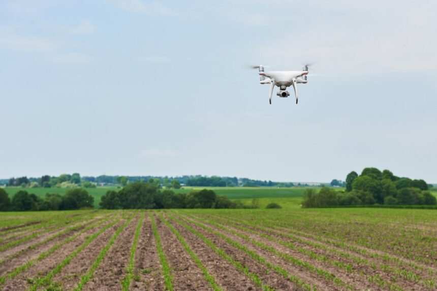
The rapid advancement of agricultural technology has introduced farmers to more efficient ways of managing crops and ensuring high yields. One of the most transformative tools in modern farming is the use of drones for crop monitoring. For South African farmers, incorporating drone technology can significantly improve the accuracy and efficiency of crop management, even in challenging climates and varied landscapes. Here’s a comprehensive guide on how South African farmers can use drones for crop monitoring effectively.
1. Why Use Drones for Crop Monitoring?
Drones provide a bird’s-eye view of farmland, allowing farmers to quickly and accurately assess crop health and field conditions. The benefits of using drones include:
- Time Efficiency: Cover large areas of land in a short amount of time compared to traditional methods.
- Precision: Identify problem areas and inconsistencies within the field with high-resolution imaging.
- Data Collection: Gather valuable data for analysis, leading to better-informed decision-making.
2. Types of Drones for Agricultural Use
There are different types of drones that farmers can choose from, each suited for specific needs:
- Fixed-Wing Drones: These are suitable for covering large areas of land quickly and are ideal for large-scale commercial farms.
- Rotary Drones (Quadcopters): More versatile and capable of hovering in one spot, making them perfect for detailed monitoring and small to medium-sized farms.
- Hybrid Drones: A combination of fixed-wing and rotary drones, these offer both long-distance coverage and the ability to hover for close-up inspections.
3. Key Uses of Drones in Crop Monitoring
A. Crop Health Monitoring
Drones equipped with multispectral or thermal cameras can detect the health of crops by capturing data that the human eye cannot see. These cameras can identify stress areas in plants caused by insufficient water, nutrient deficiencies, or pest infestations. By analyzing the captured images, farmers can take targeted action to address these issues promptly.
B. Field Mapping
High-resolution imaging from drones allows for the creation of detailed field maps. These maps can help farmers assess plant growth and identify variations in soil conditions across their fields. With accurate mapping, farmers can optimize their planting and irrigation strategies, reducing input costs and improving crop yields.
C. Pest and Disease Detection
Early detection of pests and diseases is critical to prevent widespread damage. Drones equipped with thermal imaging sensors can identify affected areas and track the spread of diseases or pest infestations, giving farmers the ability to act quickly and prevent further harm to their crops.
D. Water Management
Drones can assist in monitoring water distribution across fields, helping farmers identify areas that may be over- or under-irrigated. This data ensures that water resources are used efficiently, which is especially crucial in South Africa’s water-scarce regions.
4. Steps to Implement Drone Technology for Crop Monitoring
Step 1: Choose the Right Drone
Select a drone that fits your farm’s size and monitoring needs. Ensure it has the necessary camera attachments (multispectral, RGB, or thermal) for the type of data you wish to collect.
Step 2: Get the Necessary Training
Drone operation requires some technical know-how, and farmers should undergo training to understand how to operate drones effectively and comply with local regulations.
Step 3: Plan the Flight Path
Use software to design a flight plan that covers your entire field. Automated drone systems can be programmed to follow these paths, ensuring comprehensive data collection without the need for constant manual control.
Step 4: Capture and Analyze Data
After the drone completes its flight, the captured data can be analyzed using software designed for agricultural monitoring. Programs can highlight specific areas of concern, making it easier to pinpoint issues and develop targeted solutions.
Step 5: Take Action Based on Data
Use the insights from the data to make informed decisions, whether it’s adjusting irrigation, applying fertilizers more precisely, or targeting pesticide application only where needed.
5. Challenges and Considerations
Legal Regulations: Farmers must adhere to South African aviation laws regarding drone usage, which may require registration and permits from the Civil Aviation Authority (SACAA).
Initial Cost: The upfront investment for drones and the necessary software can be high, so farmers should assess their budget and potential return on investment.
Weather Conditions: Wind and rain can affect drone flights and data collection, so farmers should plan flights during optimal weather conditions.
6. Benefits of Using Drones for Crop Monitoring
- Improved Efficiency: Drones save time and labor, enabling faster data collection over vast areas.
- Higher Accuracy: Detailed imagery and data analysis provide precise insights that are not easily attainable through traditional monitoring methods.
- Sustainability: By using targeted interventions, farmers can minimize the overuse of water, fertilizers, and pesticides, promoting environmentally-friendly farming practices.
- Increased Yields: With better oversight of crop health and timely responses to issues, farmers can improve crop yields and reduce losses.
For South African farmers seeking to optimize their operations, drones offer an invaluable tool for crop monitoring. By investing in drone technology and understanding how to use it effectively, farmers can take a significant step towards modernizing their agricultural practices. This not only boosts productivity and profitability but also supports sustainable farming methods that can withstand the challenges of the future.
Join 'Farmers Mag' WhatsApp Channel
Get the latest Farming news and tips delivered straight to your WhatsApp
CLICK HERE TO JOIN
