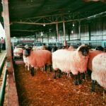
As the agricultural landscape in South Africa evolves, farmers are increasingly turning to technology to improve efficiency and productivity. One of the most promising advancements in agricultural technology is remote sensing. By utilizing remote sensing techniques, farmers can gather critical data about their fields, optimize resource use, and make informed decisions for better farm management. This article explores the benefits of remote sensing and offers practical advice for South African farmers looking to integrate this technology into their operations.
What is Remote Sensing?
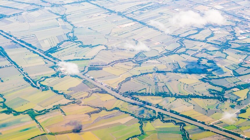
Remote sensing involves the acquisition of data about an object or area from a distance, typically using satellite or aerial imagery. This technology enables farmers to monitor crop health, assess soil conditions, and analyze environmental factors without being physically present in the field. By employing remote sensing tools, farmers can gain valuable insights that can enhance their overall farm management practices.
Benefits of Remote Sensing for Farmers
- Improved Crop Monitoring
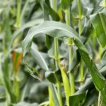
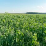
Remote sensing allows farmers to track the growth and health of their crops throughout the growing season. By analyzing satellite images or aerial photographs, farmers can identify areas of stress, disease, or pest infestation, enabling timely intervention. - Precision Agriculture
By using remote sensing data, farmers can implement precision agriculture practices. This involves applying inputs such as water, fertilizers, and pesticides only where needed, thereby reducing waste and increasing efficiency. Precision agriculture leads to higher yields and lower operational costs. - Soil Health Assessment
Remote sensing can help assess soil conditions by providing information on soil moisture, temperature, and nutrient levels. Understanding soil health enables farmers to make informed decisions regarding crop selection, irrigation, and fertilization. - Irrigation Management
Monitoring vegetation indices through remote sensing can help farmers optimize their irrigation practices. By identifying areas with varying water needs, farmers can allocate resources more effectively, reducing water waste and promoting sustainable practices. - Yield Prediction
Remote sensing technology can aid in predicting crop yields by analyzing historical data and current crop health. Accurate yield predictions help farmers plan better for harvests, market their produce, and manage resources efficiently. - Environmental Monitoring
Remote sensing provides insights into environmental factors that may affect farming, such as weather patterns, drought conditions, and land use changes. This information can assist farmers in making strategic decisions to mitigate risks associated with climate variability.
Practical Steps for Farmers to Implement Remote Sensing
- Invest in Technology
Farmers can start by investing in appropriate remote sensing technology, such as drones equipped with multispectral cameras or subscriptions to satellite imagery services. These tools can provide high-resolution data for precise analysis. - Choose the Right Software
Utilize software platforms that specialize in agricultural analytics. Many software solutions can process remote sensing data, generate maps, and provide actionable insights for farmers to implement on their farms. - Train Staff
Educate farm staff on the use of remote sensing technology and data interpretation. Training ensures that farmers can maximize the benefits of the technology and make informed decisions based on the data collected. - Collaborate with Experts
Partner with agricultural researchers, agronomists, or extension services that specialize in remote sensing applications. Collaborating with experts can help farmers understand best practices and leverage the technology effectively. - Start Small
Farmers should consider starting with a small pilot project to assess the feasibility of remote sensing on their farms. This approach allows farmers to evaluate the technology’s benefits without a significant upfront investment. - Monitor and Evaluate
Continuously monitor the impact of remote sensing on farm management practices. Evaluate the outcomes to determine whether the technology is meeting the farm’s needs and adjust practices accordingly.
Remote sensing offers South African farmers an innovative way to enhance farm management, increase productivity, and promote sustainability. By harnessing the power of this technology, farmers can make informed decisions based on accurate, real-time data. As the agricultural sector faces increasing challenges from climate change, resource scarcity, and a growing population, integrating remote sensing into farming practices will be essential for ensuring a resilient and thriving agricultural future in South Africa.
Join 'Farmers Mag' WhatsApp Channel
Get the latest Farming news and tips delivered straight to your WhatsApp
CLICK HERE TO JOIN